|
Data logging and gathering |
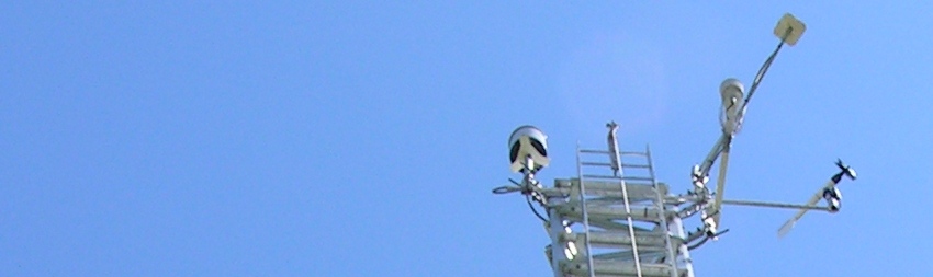
Gathering physical data from the field is accomplished with devices called Data Loggers. Such black boxes are linked to multiple sensors measuring various parameters from the environment in which they are located. These recording devices keep logs of data until their transfer to mobile computing equipment, manual change of recording memory media or upload using land lines, cell phone network, or satellite relays. |
Our company has experience in the planning, setup and operation of commercial data logging systems from providers such as Campbell Scientific or NRG Systems. We are able to setup sensor networks to monitor environmental parameters such as air temperature at different heights, water temperature strata, ground temperature gradients, wind speed and direction, solar flux, relative humidity of the air or ground water content. |
Such data can be gathered at various intervals or precision to maximize the yield without compromising integrity of time series depending on the power supplies used and method of data upload. |
We can help you evaluate the need for aerial imagery, and if required, help you organize imaging of areas of interests. Such imagery can be obtained from already available public and private sources, overflights by commercial aerial imagery providers can be setup or we can use Unmanned Aerial Systems (UAS) operated by our own business to provide you with the data you need. |
We are currently working on providing low-cost unmanned aerial imagery services compliant with Canadian regulations. When we offer this service on an open base, details and price structure will be published on this website. |
It could also be appropriate for your application to include space-based observations to frame your higher resolution local data in the proper context. Using such data can help analyze and understand ground-based observations such as air temperature gradients or observed sunlight using cloud cover as a correlated parameter. We can help you figure out what type of satellite imagery would be best, at the lowest cost or at the best quality we can get for you. |
|
|
|
|